Geography and Pre-Statehood pre-1818

























What would you like to find?

Downloadable Media: Geography and Pre-Statehood
Imagery
Audio


Illinois is a large state, reaching from Lake Michigan in the northeast to a long stretch of the Mississippi River on the west. The most important prehistoric influences on the land of Illinois were the glaciers that once covered most of the state. As these glaciers retreated they left behind flat prairie lands with rich soil and numerous rivers that flow into the Mississippi, which helped both ancient and modern people travel and transport their goods. Much of the glacial water drained into what are now the Great Lakes. This system of lakes is important to Illinois because it provides a waterway for transportation, and it is the largest body of freshwater in the world. Native Americans recognized the benefits of living on the fertile lands along the rivers of Illinois, and the Hopewell and Mississippi Valley civilization were only two of the Native American cultures that made Illinois their home. When the French explorers reached Illinois in the 1600s , the Illinois Nation, or Illiniwek—a loose confederacy including the Peoria, Kaskaskia and Cahokia—were at war with the Iroquois Nation of modern New York. The Iroquois were trying to expand into the good lands around the Great Lakes. The French helped the Illiniwek fight the Iroquois but brought diseases that killed many of the native people. Later Europeans would drive out the remaining Native Americans in order to settle on their rich lands.
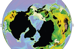
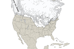
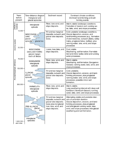
The great ice age is important to Illinois agriculture. The first glacier inched its way into Illinois about 300,000 years ago. The fourth and last glacier melted slowly away about 13,000 year ago. The glaciers flattened the land and left behind rich deposits that became the soils on which Illinois farmers have grown their crops for the last 7,000 years. The glaciers reached into Illinois as far south as Carbondale. Only the southern tip and north west corner of the state were untouched by glaciers.

Midwestern Glaciers
Midwest glaciers formed when the climate grew colder and snowfall did not melt during the summer, but continued to accumulate and crystallize into ice. In Canada, this ice layer became up to 8,000 or more feet thick. Under this heavy weight, the ice began to flow outward. Over a long period of time this outward flow reached Illinois. As a glacier advanced southward, it picked up rocks and boulders in its path, ground them up, and pushed down to the front edge of the ice as it moved forward.
Questions
What evidence of glaciers do you find in Illinois now?

Glaciers for Soil
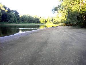
Glaciers for soil: The glacier eventually melted when the climate began to warm. The ice front receded, leaving an average of a 100-foot thick layer of sediment. As the ice sheet melted and receded, this sediment of clay, sand, gravel, pebbles, and rocks was dropped and packed down over the bedrock. It is called till, which is material directly deposited and covered by series of glacial ice sheets. The till was compressed into a heavy but not rock-like consistency.
Another type of deposit is called outwash. As the glacier melted, the water formed streams that flowed away from the face of the ice. These streams carried debris with their current. The heavier debris, such as gravel or sand, sank to the bed of the stream very near the edge of the glacier. The lightweight debris such as silt and clay floated farther downstream.
https://isgs.illinois.edu/outreach/geology-resources/quaternary-glaciations-illinois

Terrain
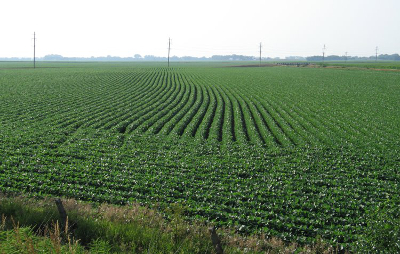
Glacial deposits of drift and loess are even textured, fine-grained, and free of rocks. They also retain moisture well. These soil characteristics enhance agriculture. In areas of Illinois that were not covered by glaciers, the bedrock is nearer the surface and the terrain is less flat. This makes agriculture more difficult.
Questions
What agricultural activities do you see in your area?
The southernmost tip of Illinois and the far northwest and western edges of the state still have pre-glacial terrain, where forests grow.
The terrain of the rest of Illinois was altered by the four glaciers that flowed and stayed over Illinois during the Ice Ages. The glaciers brought rocks and other debris to Illinois from Wisconsin and Canada and deposited them when they melted. Some of the lighter deposits were blown by winds to cover even more of the state. The vast prairies described by pioneer settlers was so flat in some areas that points thirty miles apart aried in elevation by only eight inches.

Illinois Shape
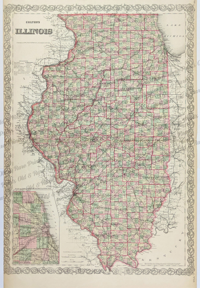
Illinois was founded and settled as a state along the Mississippi and Illinois Rivers. The territory moved north to include not only access to Lake Michigan at Chicago, but also the lead rich area of Galena. Before Illinois became a state, Native American tribes (the Sac and Fox) living in northwestern Illinois mined galena ore (lead sulfide), the source of lead. Pioneer settlers also exploited the area’s lead resources, eventually displacing the Native Americans who first mined here. In the 1820s, galena ore became the focus of the first major “mineral rush” in the United States. By the end of the 1820s, the city of Galena rivaled Chicago in size.

Rivers
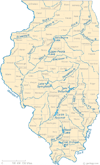
Illinois is bordered by 880 miles of rivers and has 87,110 miles of rivers and streams within its borders. The Mississippi River, Ohio River and Wabash River are the bordering rivers of the state. The Mississippi River forms the western border of Illinois in a 581 mile stretch of its course and as such is the longest river in the state. The Illinois River flows entirely within our state and is the second longest river at 332 miles. The Kaskaskia at 292 miles, Little Wabash at 237 miles and Wabash at 230 miles round out the top five longest rivers within or along Illinois' boundaries.
Questions
What river is closest to you? How do you see it being used?

Driftless area
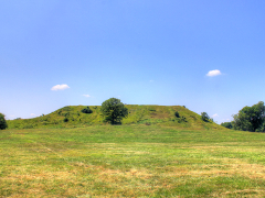
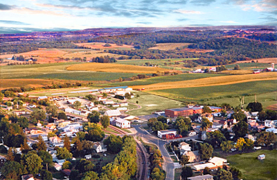
At 1,235 feet above sea level, Charles Mound is the highest elevation in Illinois. Charles Mound is located in the northwestern corner of the state near Scales Mound in Jo Daviess County. This area is known as the ‘driftless area’ because it was not impacted by glaciers during the last ice age. Because of this the area is a uniquely eroded plateau cut with deep river valleys.

Great Lakes
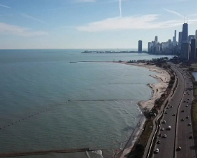
The magnitude of the Great Lakes water system is difficult to appreciate, even for those who live within the basin. The lakes contain about 23,000 km3 (5,500 cubic miles) of water, covering a total area of 244,000 km2 (94,000 square miles). The Great Lakes are the largest system of fresh surface water on earth, containing roughly 18 percent of the world’s water supply. Only the polar ice caps contain more fresh water. Illinois has 63 miles of shoreline along Lake Michigan, 22 of which are in the City of Chicago.

Charles Mound
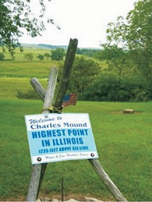
A gently rising, 1,235-foot-high hill in northern Jo Daviess County claims the title of highest point in Illinois. Located near the small town of Scales Mound and 11 miles northeast of Galena, its geographic location is 42.5042° N 90.2401° W. The peak of Charles Mound is less than one-half mile from the Wisconsin border. Charles Mound is found within the Driftless Area, a region of Illinois, Iowa, Minnesota, and Wisconsin that was untouched by the last continental glaciers. Because this area was not smoothed down by the incredible weight and force of the glaciers, it remains much hillier than surrounding areas of the Midwest. Charles Mound is located on rolling farmland. The Wuebbels, who own the land, permit the general public to access the property during the first weekends of June, July, August, and September. While Charles Mound is the highest non-man-made point in Illinois, the Sears Tower and other skyscrapers in Chicago actually rise to a greater elevation above sea level. The lowest point in Illinois is located at the confluence of the Ohio and Mississippi Rivers near Cairo in Alexander County, at 279 feet above sea level.
Questions
Charles Mound is located in a very hill area of our state. Why is this area so hilly compared to other parts of the state?
Locate Charles Mound on an Illinois roadmap. If you were describing its location to a friend who wanted to find it on her own map, what would you say?

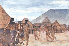
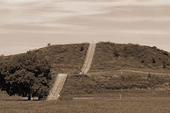
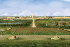
The fertile lands of Illinois have supported many great cultures. About two thousand years ago, the Hopewell civilization developed along rivers in Illinois. For four hundred years this ancient culture flourished. Most of the people lived in small villages as farmers and hunters. They built earthworks arranged in huge geometric patterns as places to bury their dead and observe the stars. The Hopewellians traded with other ancient cultures ranging from Yellowstone in Wyoming to the Gulf of Mexico in the eastern United States. Then, this civilization mysteriously disappeared. Several hundred years later it was replaced by another great civilization, known as the Mississippians. This culture farmed and traded along the Mississippi Valley and east into the Southern United states. They build one of their capitals, known today as Cahokia, in Illinois, across the Mississippi from modern St. Louis. It is characterized by its enormous temple mounds, including the largest pyramid structure north of Mexico. The Mississippians were also an agricultural people, ruled by chieftains who oversaw the distribution of food. They flourished for hundreds of years, but later declined, probably because of diseases European explorers brought to the Americas.
The first people in Illinois were probably small nomadic hunters. These hunters followed herds as they roamed. As the ice sheets melted and populations grew, early Native Americans turned to the woods, lakes and rivers for food and protection.

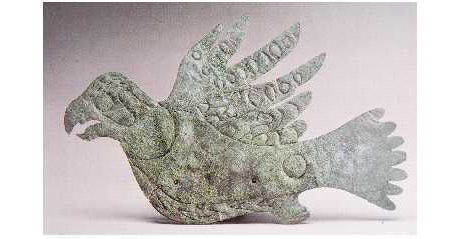
Hopewellian Artifact
Archeologist found this copper falcon in a Hopewell mound.
Questions
Why might a Hopewell artist have created this piece?
What does it tell you about the Hopewell?
How does having good land for farming help other trades develop?

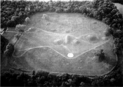
Hopewell Disappears
Around 400 A.D., the Hopewell culture disappeared. The Hopewell left no written records, only the mounds they built, and the Native Americans living in their region when the Europeans arrived knew nothing about the Hopewell Moundbuilders. Because of this, the reasons for their disappearance are a mystery. A famine or plague, like the ones that crippled Europe and Asia during the Middle Ages, may have struck. Perhaps something happened to their sources of food, or a more powerful group attacked them. Though archeologists are continuing to investigate the Hopewell and other native people who vanished mysteriously, such as the Anasazi of the Southwest, we may never know what happened to them.
Questions
What do you think happened to the Hopewell?
What would happen to a people if they could no longer farm for some reason?
How might archeologists someday learn more about the Hopewell?
National Park Service: Hopewell Culture National Historic Park


A Fight for Land
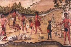
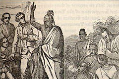
As both the French and English continued to explore the new lands of North America, both were looking for valuable natural resources to expand their empire. The Native Americans of the Illinois area supported the French and were living peaceably with them. Many tribes were trapping fur and trading with the French. When the English fought the French for control over the area we now consider the Midwest many Native Americans fought with the French. These battles were called the French and Indian War. When the English won, they took control of all lands east of the Mississippi, including Illinois.
Questions
What evidence of the French empire do you find in Illinois today?
This period of Native American culture lasted from about 10,000 years ago to about 3,000 years ago. Archaic people lived in small camps along rivers and streams. The archaic people made advances in hunting techniques and started cultivating native plants to supplement their diet.
This period of Native American culture lasted in the current Illinois area from about 3,000 years ago to 1,250 years ago. In addition to introducing pottery vessels for food shortages, the Middle Woodland people began using the bow and arrow to hunt for food.
Lasting from about 1,100 years ago to about 500 years ago, the Mississippian people had a more stable cultivated food supply of corn, squash and some beans. Additionally, the Mississippian people are known for building ceremonial and burial mounds such as Monks Mound near Cahokia in southwestern Illinois.


Lost Race
When early European settlers came to the Ohio River Valley they were astonished at what they saw. Large earthworks in the form of mounds, several miles long, dotted the landscape. Over a thousand mounds were located in valley areas along the Ohio River, on hilltops overlooking the river, and far up major tributarjes. The Europeans theorized that these artifacts must be the work of a glorious ancient people who bore no relationship to the "savages" who then occupied the valley. This "lost race" was thought to be the lost tribe of Israel, or perhaps the remains of the great culture of Atlantis. Archeologists have disproved these early theories and have shown these artifacts to be the work of ancestors of Indians who occupied the valley at the time the Europeans came. The mounds were built by two early groups of ancient Indians: the Adena (700 B.C. - 400 A.D.) and the Hopewell (200 B.C. - 500 A.D.). The Mound Builders were the first Ohio River Valley Indians to use pottery to cook and store food. They also began cultivating certain wild plants. This early agriculture supplemented the hunting and gathering of forest resources, which dwindled as the population increased. The Mound Builders also introduced the practice of burying their high-status dead with extravagant grave goods and burial mounds.
Questions
How does productive land help civilizations grow?
Why was it hard for Europeans to believe that Native Americans might have built the mounds?
EPA, Historic Influence and Implications of the Ohio River
As the United States was being settled by European immigrants, specifically on the eastern seaboard, many native tribes were moving west. In 1673 as Marquette and Joliet explored the land that is now Illinois, they discovered the Illinois or Illiniwek people.

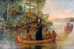
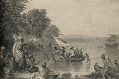
The first Europeans to come to Illinois were probably Louis Jolliet, a French explorer, and Father Jacques Marquette, a missionary, traveling from Canada in 1673. The French built a few missions and trading outpost, and some traders intermarried with the native people. France lost Illinois to Britain after the French and Indian War ended in 1763, The British restricted settlement there to preserve the land for Native Americans, but a few traders and settlers pushed into the area anyway. The Ordinance of 1787 made Illinois part of the U.S. Northwest Territory. After the War of 1812 the government drove out the Native American who had fought against the U.S., opening the way for more settlers. The first settlers avoided the wide, open prairies because they believed id no trees grew there, the ground was not very fertile. Yet, the prairies were covered with tall, thick grasses. Even so, occasionally they were burned by sweeping fires. Early settlers stayed near the woods and rivers, where they cleared a spot to farm, cut timber to build their homes and fences, and used the rivers to transport their crops to market. Prairie life called for new kinds of farming. Though many of the settlers came from the South they did not build plantation, and slavery was generally illegal. Corn became the most important crop in Illinois, and farmers found that it did even better than wheat or cotton in the fertile prairie soils.
The first Europeans to come to Illinois were probably Louis Joliet, a French explorer, and Father Jacques Marquette, a missionary, traveling from Canada in 1673. The French built a few missions and trading outpost, and some traders intermarried with the native people.

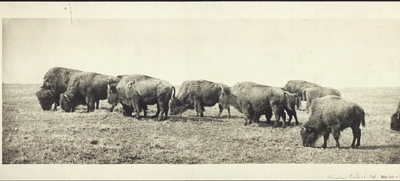
Bison
When settlers first came to the prairie, bison were still a common sight. Native Americans and pioneers followed the bison trails that cut through the tall prairie grass, and hunted the animals for their meat and skins. Eventually, bison came very near to extinction because they were over-hunted, and sometimes killed just for sport.

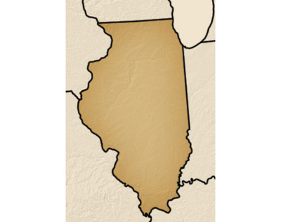
Illinois Statehood
The state of Illinois is 55,584 square miles. The Mississippi River is the state's western border, and Lake Michigan is at its northeast border. Chicago, a port on the lake, is the nation 's third largest city. Most of the state is made up of prairie land, crossed by several rivers that flow into the Mississippi. Illinois is also part of the fertile corn belt. The summers are hot, with cold winters. The southern part of Illinois is known as "Egypt," where cities have names like Cairo and Thebes, perhaps because the fertility of the Mississippi Valley there reminded some of the early settlers of the Nile in Egypt.

La Salle
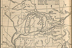
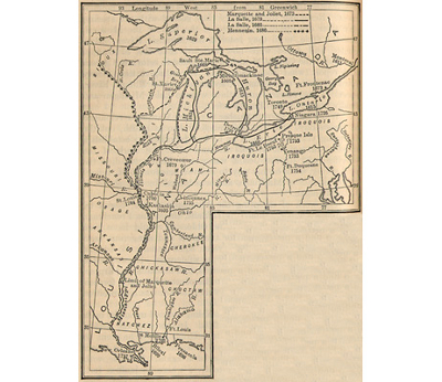
The French dreamed of adding the Mississippi Valley to their overseas Empire. In the summer of 1673, Louis Jolliet and Father Jacques Marquette made a pioneering voyage up the Mississippi. Marquette later established missions in the area. The French explorer and empire builder Rene Robert Cavelier, Sieur de la Salle, founded Fort Crevecoeur at the southern end of Lake Peoria. He left the fort under the command of Henry de Tonty, whose hand, lost in battle, had been replaced with an iron hook. On his way up the Illinois River, La Salle noted the natural fortification now called Starved Rock and sent Tonty a message to occupy it in case of an Iroquois attack, because the French were allied with local Indians against the Iroquois. Tonty moved there in April 1680, but he did not fortify it and the Iroquois drove him out, along with his Illinois allies.After La Salle and Tonty started construction of Fort St. Louis atop Starved Rock in 1682, groups of Miamis and Shawnees joined them. In the latter part of 1683, the Kaskaskia and other Illinois bands returned. In all, about 20,000 Indians gathered in the neighborhood, including some 3,880 warriors. But the Iroquois attacks continued, and drove away France's allies. As their confederacy fell apart, La Salle's dream of an Indian empire vanished. The French stayed in Illinois, and settled the new village of Kaskaskia in 1703. By 1754, France still had a strong relationship with a number of Native-American tribes in Canada and along the Great Lakes. It controlled the Mississippi River by establishing a line of forts and trading posts there, preventing the British colonists from moving westward. These and other pressures between Britain and France led to the conflict known as the French and Indian War in America, or the Seven Years' War in Europe. Only a modest po1tion of it was fought in the Western Hemisphere. In the Peace of Paris (1763), France relinquished all of Canada, the Great Lakes, and the territory east of the Mississippi to the British. The dream of a French empire in N01th America was over, and Britain now had to try to manage a much larger Empire, resorting to new policies that would lead its American colonists to rebellion.
Questions
Why did La Salle want an Indian empire?
Why would the Mississippi River Valley be a good place for an empire?
Who else competed with the French to build an Empire there?
National Park Service, Explorers and Settlers: Old Kaskaskia Village Site; U,S. Department of State , Outline of ,U, S History.)
The French explorer and empire builder Rene’ Robert Cavelier, Sieur de la Salle, founded Fort Crevecoeur at the southern end of Lake Peoria. He left the fort under the command of Henry de Tonty, whose hand, lost in battle, had been replaced with an iron hook. On his way up the Illinois River, La Salle noted the natural formation now called Starved Rock and sent Tonty a message to occupy it in case of an Iroquois attach, because the French were allied with local Indians against the Iroquois. Tonty moved there in April 1680, but he did not fortify it and the Iroquois drove him out along with his Illinois allies.
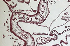
The French stayed in Illinois and established new settlements along the Mississippi River. In 1699 they established a permanent settlement at Cahokia. In 1703 they settled in the new village of Kaskaskia. By 1754, France still had a strong relationship with a number of Native American tribes in Canada and along the Great Lakes. The French controlled the Mississippi River preventing the British colonist from moving westward.
In 1703, the French established a permanent settlement at Kaskaskia, it would later become the site of the first state capitol.
Continued pressure and conflicts between Great Britain and France lead to the conflict known as the French and Indian War, or the Seven Years’ War in Europe. Only a modest portion of this war was fought in the Western Hemisphere. In the Peace of Paris (1763), France relinquished all of Canada, the Great Lakes and the territory east of the Mississippi to the British.
During the American Revolution, Illinois was considered part of the State of Virginia. George Rogers Clark raised an army under the control of the State of Virginia and led his army to peacefully seize control of Forts Kaskaskia and Vincennes.
After the American Revolution, the new U.S. Government established rules to encourage settlers into the new frontier. As part of the Northwest Territory, education and religious freedom were important, slavery was not allowed, and settlers were allowed trial by jury.


Northwest Ordinance
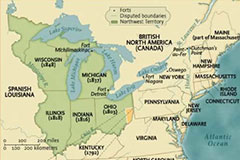
The most important act of the government under the Articles of Confederation was the establishment of the Northwest Territory under the Ordinance of 1787. The Ordinance applied to territory northwest of the Ohio River , and included these articles:
" ART. 1. No person, demeaning himself in a peaceable and orderly manner, shall ever be molested on ac count of his mode of worship or religious sentiments, in the said territory.
" ART. 2. The inhabit ants of the said territory shall always be entitled to the benefits of the writ of habeas corpus , and of the trial by jury; of a proportionate representation of the people in the legislature; and of judicial proceedings according to the course of the common law. All persons shall be bailable, unless for capital offenses , where the proof shall be evident or the presumption great. All fines shall be moderate; and no cruel or unusual punishments shall be inflicted. No man shall be deprived of his libe11y or property, but by the judgment of his peers or the law of the land ..
"ART. 3. Religion, morality, and knowledge , being necessary to good government and the happiness of mankind, schools and the means of education shall forever be encouraged. The utmost good faith shall always be observed towards the Indians; their lands and property shall never be taken from them without their consent; and, in their property, rights, and liberty, they shall never be invaded or disturbed, unless in just and lawful wars authorized by Congress; but laws founded in justice and humanity, shall from time to time be made for preventing wrongs being done to them, and for preserving peace and friendship with them. . . .
"ART. 5. There shall be formed in the said territory, not less than three nor more than five States And,
whenever any of the said States shall have sixty thousand free inhabitants therein, such State shall be admit ted, by its delegates, into the Congress of the United States, on an equal footing with the original States
in all respects whatever, and shall be at liberty to form a pe1manent constitution and State government: Provided, the constitution and government so to be formed, shall be republican, and in conformity to the principles contained in these articles . . .
"ART. 6. There shall be neither slavery nor involuntary servitude in the said territory, otherwise than in the punishment of crimes whereof the party shall have been duly convicted "
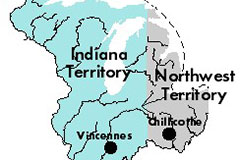
In 1800, Illinois became a part of the Indiana Territory. Because settlers had started moving into the area, many felt the size of the Northwest Territory was too large to provide protection from Native Americans and to have control over property and land rights.
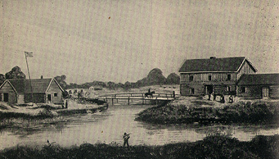
In 1803, the U.S. Congress authorized a new fort to be located on Lake Michigan near the Chicago River. Named after Henry Dearborn, an American Revolution hero and Secretary of War under Thomas Jefferson, the fort was situated across the river from a farm and trading post established by Jean du Sable. Many believe the word Chicago is translated from the Native American word that means ‘the place of bad smells’ because the river and swampy area around it had a distinct odor. Fort Dearborn was the site of a bloody battle during the War of 1812 between the United States and Great Britain.

City of Chicago
The history of Chicago, the largest American city that borders the Great Lakes, is directly linked to Lake Michigan. The Miami Indians of the Illiniwek Nation settled in a village they called "Che-cau-gou" on the southern extremity of Lake Michigan in the 1640s. By 1682, French explorer La Salle claimed the Mississippi River Valley for France and called the portage he crossed from St. Joseph River in Michigan to the Illinois River the "Chicago Portage," after the Miami Indians' name for the region. In 1779, Haitian-born fur trapper, Jean Baptiste Point Du Sable, established a trading post at the mouth of the Chicago River, contributing to the fur trade's role in the exploration of the West. Du Sable--of mixed French and African ancestry--was one of many traders in the Midwest who bought furs from the native people and paid for them with iron pots, steel axes, woolen blankets, and a variety of other commodities that had already, by the 1770s, profoundly changed the lives of Native Americans. Chicago Portage became an important point linking Lake Michigan to several rivers in the region and soon became the leading port in the West. Between 1833 and 1839 the annual average import trade for Chicago was $1.5 million and the export trade was $350,000. Lake Michigan was one of the chief economic engines behind the development of Chicago and the rest of Illinois. Congress, recognizing the importance of Chicago's harbor, appropriated $247,000 for its development by the end of 1844. By the late 1800s, the people of Illinois were already experiencing the effects of the pollution of Lake Michigan: sewage that flowed through the Chicago River into Lake Michjgan caused plagues of typhoid fever, cholera and dysentery. In 1887, Chicagoans decided to embark on their first Great Lakes restoration effort. They boldly dared to reverse the flow of the Chicago River in attempts to stop the sewage in that body of water from flowing into Lake Michigan, which was their drinking water source. They accomplished this in 1900. Lake Michigan remains vital for Illinois and other surrounding states. It provides drinking water for six million people in Illinois and continues to serve as an avenue for commerce.
Questions
Why did Chicago become an important city?
Why was the government willing to invest money in the city?
Why is it important to take care of the environment?
US EPA An Atlas of Biodiversity: People on the Land, National Park Service, Wilderness and Civilization 1700- 1800, and United States senator Dick Durbin, issues and legislation: Great Lakes Restoration
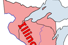
In 1809, the U.S. Congress formed the Illinois Territory that includes present day Illinois, Wisconsin and Part of Michigan and Minnesota. This was due to continued settlement of the area and the fact that the settlers felt the government was still too far away to protect and serve them.
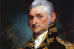
In 1809 Ninian Edwards was named the governor of the Illinois Territory. He served from 1809 until the territory was dissolved in 1818.
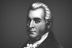
In 1816 Nathaniel W. Pope was selected as a Delegate to the United States House of Representatives for a two year term representing the Illinois Territory. Pope was the cousin of Illinois Territorial Governor Ninian Edwards

 topics

